![]()
James Abbott McNeill Whistler. 1834-1903.
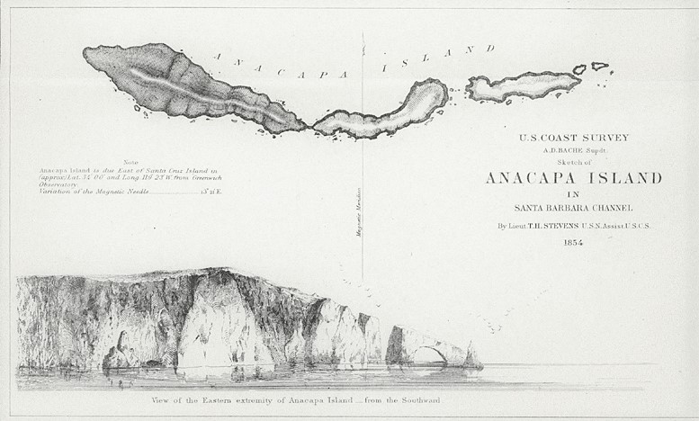
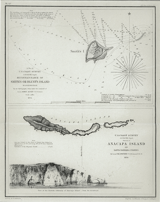
Anacapa Island. 1854. Etching. Kennedy Appendix 1; Glasgow 2.5 1/4 x 9 (sheet 14 x 10 7/8). With lettering at the top, above the ruled frame: 'PLATE No. 414'; within the frame, at centre top: 'ANACAPA ISLAND'; at the right: 'U. S. COAST SURVEY / A. D. BACHE, Supdt./ Sketch of ANACAPA ISLAND / IN / SANTA BARBARA CHANNEL / By Lieut. T. H. STEVENS, U. S. N. Assist. U. S. C. S. / 1854'; at the left: Note. Anacapa Island is due East of Santa Cruz Island in (approx.) Lat. 34 [degrees] 00' and Long. 119 [degrees] 23' W. from Greenwich Observatory. Variation of the Magnetic Needle, 13 [degrees] 21' E.'; at the bottom centre, 'View of the Eastern extremity of Anacapa Island - from the Southward.'; at the centre, a vertical arrow indicates 'Magnetic Meridian'; at the bottom, under the ruled frame, on the left, 'Drng by W. B. McMurtie' and on the right, 'Engg by J. A. Whistler, J. Young & C. A. Knight.' Printed on cream wove paper, with the usual center fold, as published. $975.
The copper plate itself is dated 1854. It was etched in November or December 1854. It must date from shortly after Whistler was hired to work as a draughtsman in the U.S. Coast Survey in Washington by the federal government on 7 November 1854, for $1.50 a day, and before the etching was published. It bears a publication date of 1854. Whistler was dismissed on January 9, 1855.
This legendary map is composed of two maps on one sheet, one for a coastal island off of Washington, and the depiction of the Anacapas off of Santa Barbara. A handsome shore profile depicts rugged coast, and in the distance we see flocks of birds flying toward the horizon.
![]()
Please click on the link to the Glasgow online catalogue raisonné Anacapa Island.
![]()
To order or to request additional insormation, contact Jane Allinson (jane@allinsongallery.com) or call (860) 429 2322.
Please click here to review the USE AND ACCEPTANCE AND PRIVACY POLICIES FOR THE ALLINSON GALLERY, INC. WEBSITE